|
Wildcliff Nature Reserve
Dedicated
to
plant and wildlife conservation in South Africa's Cape Floral Kingdom
Map Galleries
Map Catalog|
Atlas|
Environment|
Climate
|
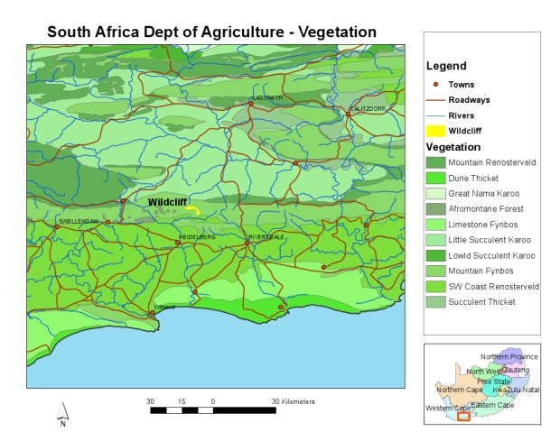
Regional Vegetation
Wildcliff offers an outstanding example of the flora of the reknowned Cape Floristic Region.
South Africa has the third-highest level of biodiversity in the world, thanks in no small part to
the Cape Floral Kingdom. The Table Mountain National Park alone has more plant species within its
22,000 hectares than the whole British Isles or New Zealand. A stretch of land and sea spanning
90,000 square kilometres, or 0.05% of the earth's land area, the Cape floral kingdom contains
roughly 3% of the world's plant species. Of the 9,600 species of vascular plants found in the
Cape floral kingdom, about 70% are endemic, ie occur nowhere else on earth.
|
|
|
|
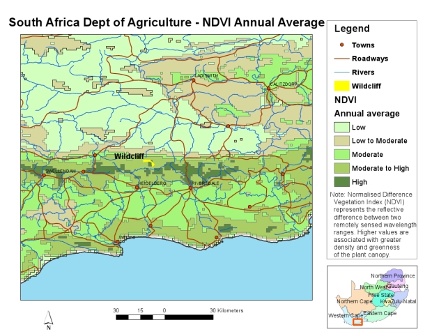
Regional NDVI
The NDVI (Normalized Difference Vegetation Index) is derived from NOAA Satellite Imagery
and provides a measure of the density and vigor of green vegetation growth. An index of zero
indicates rock or bare soil; negative values correspond to open water. Indices of 0.1 to 0.6
indicate vegetation, with higher values associated with greater density and greenness of the plant canopy.
|
|
|
|
Regional Soil Associations
The SOTER Soil Association categories are internationally recognized groupings of known soil types.
The major soil groups in the Wildcliff immediate area are G1 (rock with limited soils) and
C1 (soils with a marked clay accumulation).
|
|
|
|
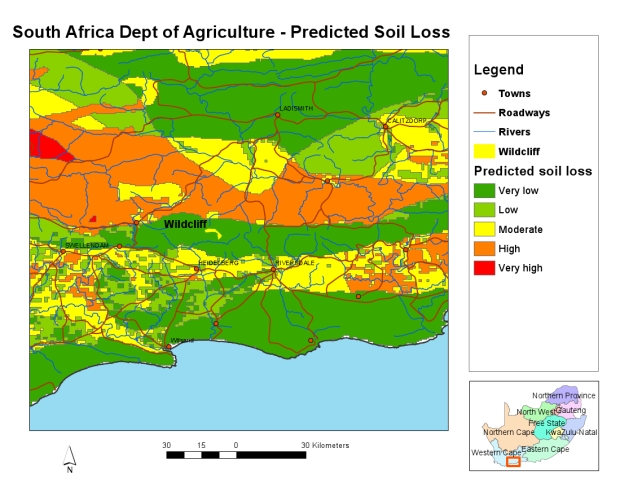
Regional Predicted Soil Loss
All soils lose soil at some rate over time. Some soils are prone to lose more than others,
due to certain soil conditions such as slope, depth and texture. Wildcliff is located in an
area where soil loss potential is low, but is surrounded by soils that have a much higher
loss potential.
|
|
|
|
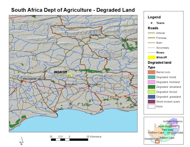
Regional Degraded Lands
Depending on land use, climate, and vegetation cover, soils with the same soil loss potential
may be more or less degraded. Only small areas of land in the region of Wildcliff are classified
as degraded.
|
|
|
|
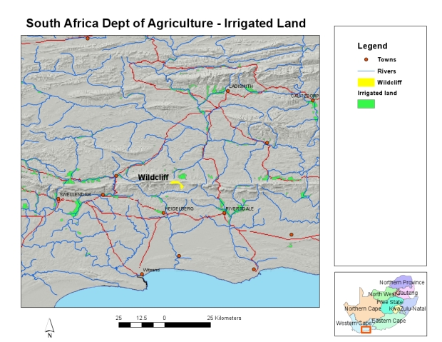
Regional Irrigated Lands
Irrigation of lands for the purposes of agriculture can have immediate benefits for the
production of crops, but can have detrimental effects on the groundwater and surface
accumulation of salts. In the Wildcliff area only a few small plots of irrigated
lands are identified in this map.
|
|
|
|
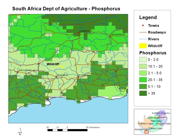
Regional Soil Phosphorus
Phosphorus is an important plant nutrient that can effect the vigor and amount of vegetative growth
if it is insufficient in the natural soil. Fertilizers can supplement natural phosphorus levels
to enhance cultivated crop production. Wildcliff is located in a lower phosphorus zone, surrounded
by areas of higher concentration.
|
|
|
|
Where not otherwise specified, the data used in the maps came from three major sources:
-
Digital Chart of the World (DCW).
This dataset consists of general background layers (roads, towns, streams) that
represent feature locations accurate to a approximately 2 kilometers. The DCW was
developed by ESRI for the US government in 1992.
-
South African Agriculture GIS (AGIS).
The South Africa National Department of Agriculture provides a number of valuable spatial
datasets through this distribution network. At a scale of 1:500,000, this is the best
resolution spatial data that is readily available about the environment.
-
Chief Directorate: Surveys and Mapping.
This agency is part of the South Africa Department of Land Affairs the highest resolution
data that is available at the national level. The 1:50,000 scale layers represent the
location of natural and man-made features, including 20 meter contours.
Detailed Maps and the Dynamic Map Gallery were produced by
Horizon Mapping.
We welcome
comments, or enquiries from potential volunteers or researchers.
Contact us for
information or browse the research
opportunities page.
Wildcliff is a
registered
|
 |
Conservation Area
|
|