|
 |
Horizon Mapping
Farmers' Voice: Bangladesh Map Galleries
|
|
|
|
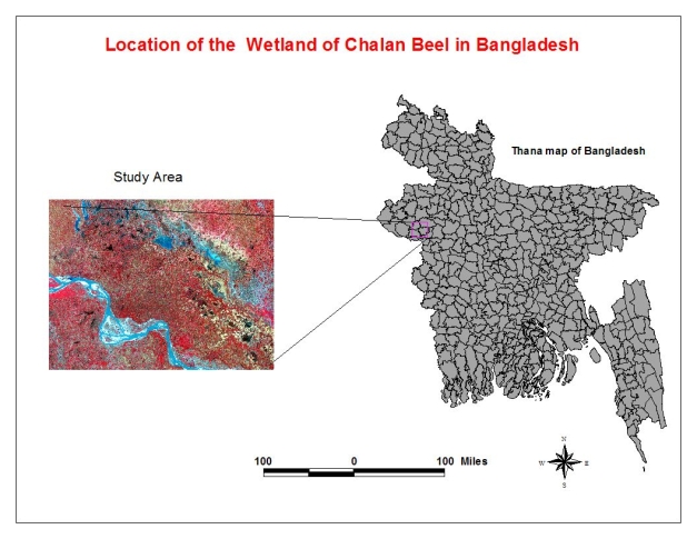
Chalan Beel Wetland
Chalan Beel is a large inland depression, marshy and rich with flora and fauna. This extensive lowland
in the Atrai basin consists of a series of beels or wetlands connected to each other by channels to form a
continuous water body during the rainy season. In the winter months, the wetland dries out, leaving
only patches of water in the cental parts of the zone.
(Source: Wikipedia
Chalan Beel)
|

|
|
|
|
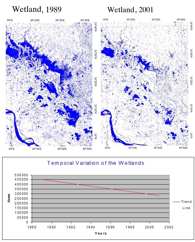
Chalan Beel, 1989-2001
Wetlands are among the most diverse and productive ecosystems in the world. They improve water
quality, store floodwaters, provide habitat for fish, birds and wildlife, and are a valuable source
of food. The Chalan Beel wetland, however, is fast silting up. In the past it covered an area of about
1,085 kmē but was reduced to 368 kmē in 1909, of which only 85 kmē remained underwater throughout the
year. It has since shrunk to only 26 kmē.
(Source: Wikipedia
Chalan Beel)
|

|
|
|
|
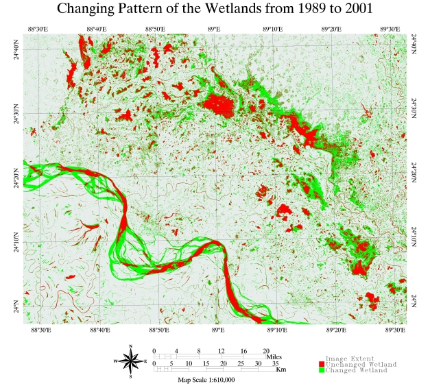
Chalan Beel, Changing Patterns
The most important factor dominating the river history in Chalan Beel is the large proportion of
silt carried by its rivers. It is the silt which creates land and makes it habitable. It is silt
which is fertilising the land, but the silt has also produced most of the river problems
now confronting the people of the area. Silt deposited in the old river channel beds has forced
them to change course, creating problems for abandoned areas while assisting in developing new
areas.
(Source: Wikipedia
Chalan Beel)
|

|
|
|
|
|
 |
|