|
 |
Horizon Mapping
Farmers' Voice: Bangladesh Map Galleries
|
|
|
|
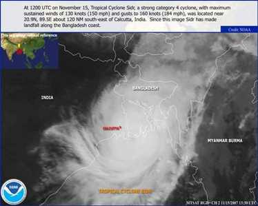
Satellite Image of Cyclone Sidr, November 15, 2007
With the approach of Cyclone Sidr to the Bangladesh coast, officials were able to warn the
public so that over 650,000 people could evacuate the path of destruction. This was inspite
of a lack of proper infrastructure and undeveloped transportation network. The number of
people who have died is over 3000, but this is far less than in the 1991 Bangladesh Cyclone
when 140,000 people lost their lives.
|

|
|
|
|
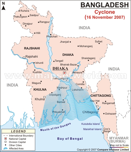
Areas Affected by Cyclone
The eye of Cyclone Sidr came ashore in the Sundarbans Forest, which is the least populated
coastal area of the country. The Sundarbans, however, is a UNESCO World Heritage site and
is home to a wide variety of plants and animals. This biodiversity hot spot may have suffered
large losses of mangrove trees, deer and endangerd Bengal Tigers.
|

|
|
|
|
Areas at Risk from Storm Surge
The triangular shape of Bengal Bay funnels high storm surges into the apex of the triangle
where Bangladesh sits, and the shallow bottom of the bay allows extraordinarily high surges
to pile up. The low elevation of coastal areas allows the affect of these surges to penetrate
far inland and coupled with heavy rains leads to wide spread flooding.
|

|
|
|
|
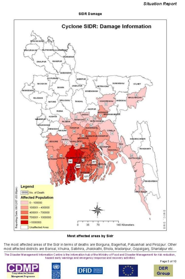
Cyclone Related Deaths
The map below indicates where human loss from Cyclone Sidr occurred and it is clear the
people of Bangladesh have suffered a massive natural catastrophe. Along with the loss of
life has also come environmental devestation. Especially now, when
the biodiversity of the area is threatened, it is important for the
communities to assess and recover from the loss of this prime source of livelihood.
The Farmers' Voice Research Institute has been working with
local farmers to preserve and foster existing wisdom and knowledge so that redevelopment
can begin.
|

|
|
|
|
|
 |
|