|
 |
Horizon Mapping
Farmers' Voice: Bangladesh Map Galleries
|
|
|
|
Sundarban Mangrove Forest
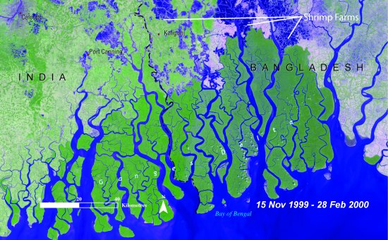
The Sundarban is the largest mangrove forest in the world. It is situated in the southwestern
part of Bangladesh and in the West Bengal state of India. Despite high population pressure and
environmental hazards such as siltation, cyclone flooding and sea level rise, the areal extent
of the mangrove forest has not changed significantly in the last 25 years.
|

|
|
|
|
Bay of Bengal
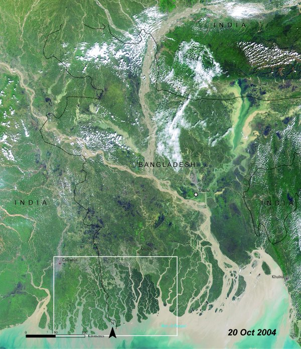
The Sundarban Forest is guarded by the Bay of Bengal. The area is an excellent example of
the coexistence of human and terrestrial plant and animal life. In fact, with improved
management, the tiger population has increased from a mere 350 in 1993 to 500-700 in 2000.
|

|
|
|
|
Coastal Flooding
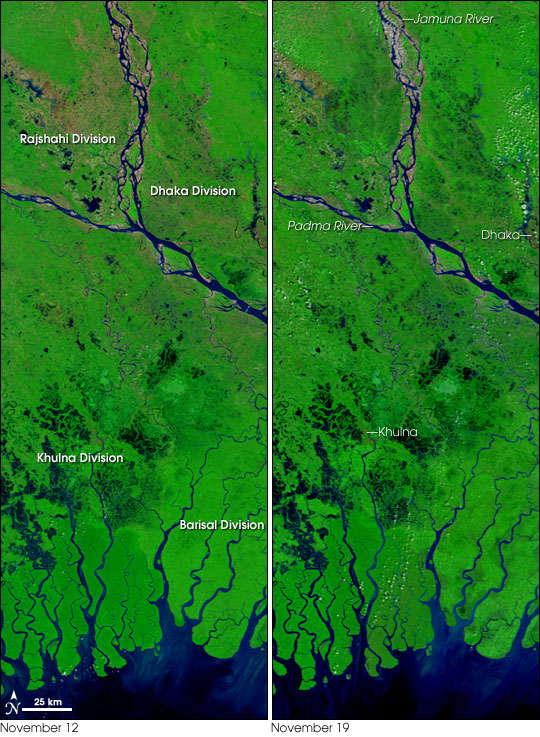
Bangladesh is low-lying, traced by innumerable rivers and streams, and densely populated,
making it exceptionally vunerable to floods. Widespread flooding is common during the wet
season and is beneficial for the soil. A cyclone, however, produces a devastating level of
flooding from rains and storm surge. These satellite images show the area affected by Cyclone
Sidr before and after. The blue of flood waters mixes with green vegetation to create a
bruised look.
|

|
|
|
|
Ecosystems
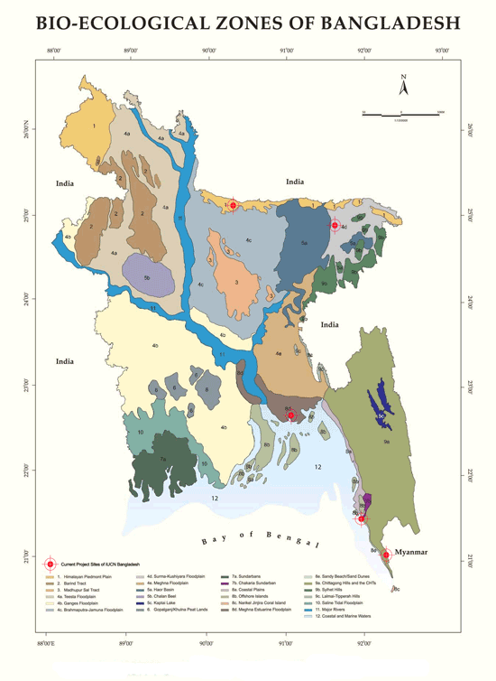
Bangladesh is deltaic in origin with a flat terrain and low relief and nearly 50% of the
country lies below the mean sea level. There are predominantly three types of landscapes
in the country: floodplains spread over 80% of the land area, terraces covering 8% and
hills dispersed over 12% of remaining land area. Bangladesh is primarily an agro - based
economy with the primary sector accounting for 33% of the GDP and employing 65% of the
labour force. People’s lives and livelihoods are thus intricately linked with nature and
its bounties and they harness biodiversity products such as agriculture and fisheries.
|

|
|
|
|
|
 |
|